

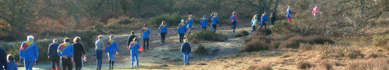
Want to have a try at orienteering but can't get to an event, or don't want to? Do you feel the need to practice your orienteering technique without the distractions of an event? We support a number of permanent orienteering courses (POCs) in our area. These are in country parks or similar sites where public access is permitted. They usually consist of a series of marker posts dotted around the site, each with code letters or numbers marked on. Maps are obtainable at a small charge from a shop or visitor centre on site, or by contacting the details given.
Please note that possession of a POC map does not in itself confer the right of access to an area. You must respect any terms and conditions such as opening times, parking charges etc which apply to the general public.
HOC POCsArrow Valley Country Park, Redditch
Country Park with a mixture of open land and dense woods.
Directions OS Grid Ref SP065677. Access from Battens Drive, Redditch, B98 0LJ
and other points on the perimeter.
Maps available at https://www.britishorienteering.org.uk/poc/arrow_valley_country_park
Barr Beacon, near Aldridge
Country park on prominent local hill (with the obligatory covered reservoir on top). Fantastic views on a clear day.
Maps are only available by free download at https://www.britishorienteering.org.uk/poc/barr_beacon.
Directions OSGR SP061973. Access from B4154 (Beacon Road), south of Aldridge town.
Map
Brockhampton Estate, near Bromyard
National Trust site with a mixture of open parkland and woods set in attractive rolling landscape. Toilets and refreshments on site.
Maps available from the tearoom and entrance kiosk.
Directions OSGR SO683549 off the A44 approx 2 miles east of Bromyard.
More information on the
National Trust website.
Comments and times.
Callow Hill, Wyre Forest
Mixed woodland, one of HOC's best areas. A mixture of control sites to suit all levels of experience. Paths are wheelchair-accessible. Other attractions including cafe and toilets.
Maps on sale at the Visitor Centre.
Directions OSGR SO752740 off the A456 3km west of Bewdley Location map
Contact Wyre Forest Visitors Centre, Callow Hill, near Bewdley. Tel: 01299 266944 Email: wyre.forest.discovery.centre@forestry.gsi.gov.uk
More about this venue on the Forestry Commission website
Clent Hills, near Stourbridge
Prominent hill with mixed open areas and woodland. Extensive path network and a mixture of control sites to suit most levels of experience. Cafe and toilets on site.
Maps on sale from the cafe at Nimmings car park (excellent bacon sandwiches for afterwards!)
Directions OSGR SO938807 off Hagley Wood Lane south of the A456 between Halesowen and Hagley Location map
More about this venue on the National Trust website
Croft Castle, near Ludlow
National Trust site with a mixture of parkland, fields and an extensive wooded valley. Toilets and refreshments on site.
Maps available from the entrance kiosk.
Directions 10km W of Woofferton (A49/B4362) and 4km E of Mortimers Cross. Follow the National Trust signs to Croft Castle (Cock Gate) at map ref. SO462655. National Trust car park.
More about this venue on the National Trust website
Dudmaston Hall, near Bridgnorth
National Trust site based on a pleasant wooded valley containing a series of lakes. Toilets and refreshments on site.
Maps available from the visitor centre (check availability).
Directions A few miles south of Bridgnorth on the A442. See separate map for car parking and access to the course.
More about this venue on the National Trust website
Fibbersley Local Nature Reserve, Willenhall
Jointly developed with WCH on reclaimed industrial land turned nature reserve. Courses and controls
suitable for various levels of fitness and experience. No toilets or refreshments on site.
Maps and other information at
https://www.britishorienteering.org.uk/poc/fibbersley.
Directions OSGR SO956992 off Noose Lane.
Hawkbatch, Wyre Forest
Mixed mature woodland.
Maps on sale at the Callow Hill Visitor Centre (see the entry for the Callow Hill POC above).
DirectionsCar park entrance OSGR SO761777 off the B4194 2km northeast of Bewdley Location map
Contact Wyre Forest Visitors Centre, Callow Hill, near Bewdley. Tel: 01299 266944 Email: wyre.forest.discovery.centre@forestry.gsi.gov.uk
More about this venue on the Forestry Commission website
Himley Hall, Wombourne
Landscape by Capability Brown at the former seat of the Earls of Dudley. Open parkland with wooded hill on one side. Controls suitable for beginners and those with limited experience. Cafe and toilets on site.
Maps available from Himley Hall, 01384 817817.
Directions OSGR SO884912 off the B4176 Wombourne-Dudley road just east of its junction with the A449.
More about this venue on the Dudley Council website
Rough Wood, Willenhall
Jointly developed with WCH on reclaimed industrial land turned nature reserve. Courses and controls
suitable for various levels of fitness and experience. No toilets or refreshments on site.
Maps and other information onthe
https://www.britishorienteering.org.uk/poc/rough_wood.
Directions GR SJ982008 off Hunts Lane, which is best accessed from the A462, and then Bloxwich Road North, to the north of Willenhall. Map
Sandwell Valley, West Bromwich
Large country park with mixed open and densely wooded
areas, adjoining the slightly more formal Dartmouth Park. Lots of other attractions including a working 'Victorian' farm and walled kitchen garden, nature trails, tea room and toilets. A mixture of control sites to suit most levels of experience.
Maps on sale at the Sandwell Park Farm Visitor Centre.
Directions OSGR SP012918 off Salter's Lane. Signed from the A4031 on the West Bromwich side of the M5 Location map
Contact Sandwell Park Farm, Salter's Lane, West Bromwich B71 4BG.
Tel: 0121 553 2147 (general number for Sandwell Park Farm)
More about this venue on the Sandwell Council website
Shire Oak Park, Walsall
Old sand quarry converted to nature reserve. A compact area with complex contours and extensive path network.
Maps and more details available at https://www.britishorienteering.org.uk/poc/shire_oak
Directions OSGR SP057039 off Andrews Road. Signed from the A461 near Brownhills
This website contains mapping data licensed from Ordnance Survey with the permission of the Controller of Her Majesty's Stationery Office. © Crown Copyright. All rights reserved. Licence number PU43423U.
Please note that information, views, statements and images forming part of this site are subject to the site disclaimer.
There are POCs all over the country. A list of all permanent courses registered with British Orienteering are on their website; follow the links to Try Orienteering - Newcomers' Guide - Community Orienteering. More...
HOC's neighbour club Octavian Droobers (Warwickshire) supports some unregistered
POCs not too far away from our area. More...