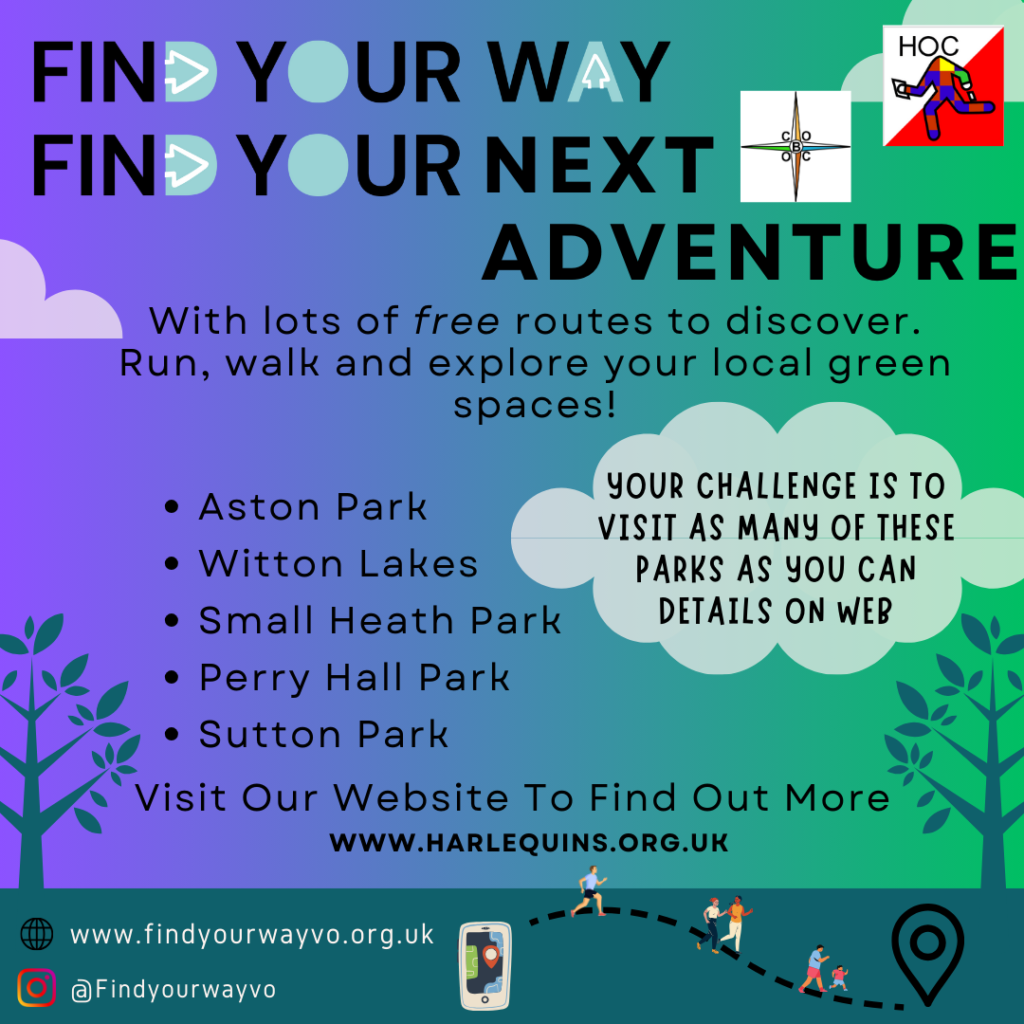
Find Your Way at Easter
The Find Your Way project has its own website here
The Find Your Way project is a Sport England funded project to get more people engaged and active in their local spaces through virtual orienteeing activities.
It is a collaboration between orienteering clubs and local community partnerships to create exciting bespoke activities in local green and urban spaces to get people exploring their surroundings.
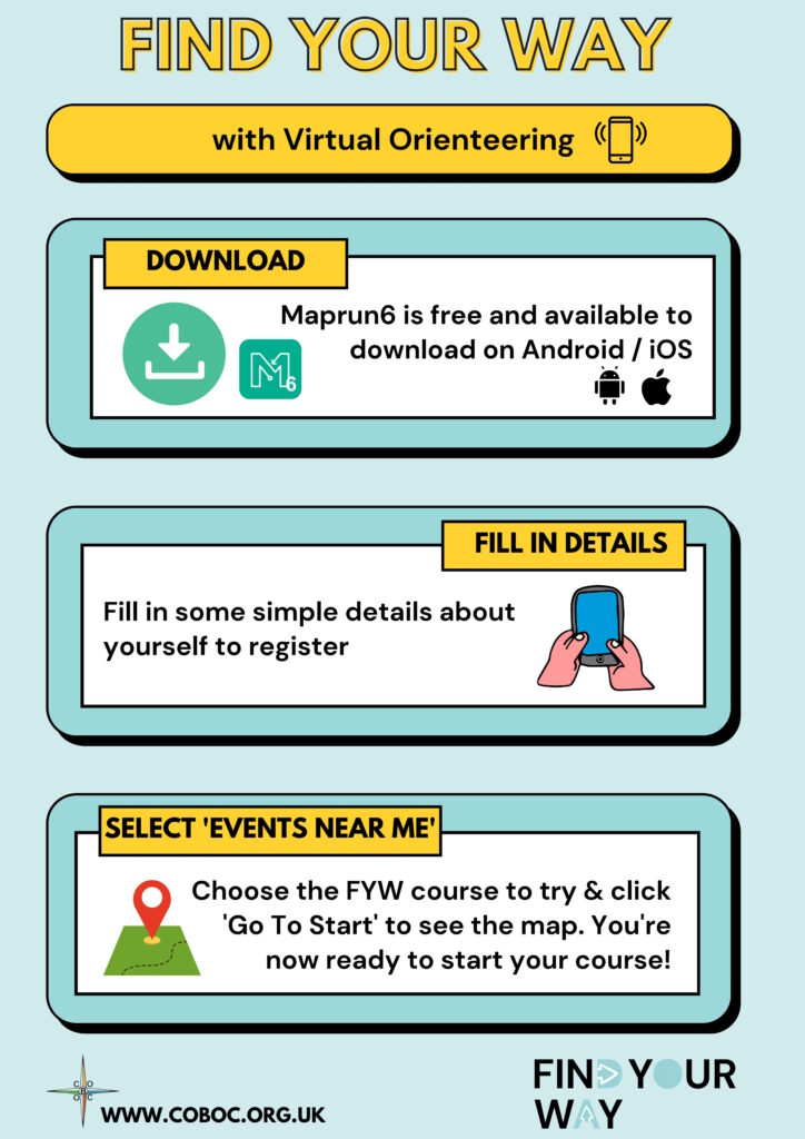
First, download the Maprun6 App:
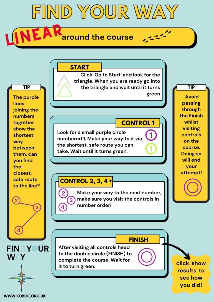
Once you’ve set up the phone and arrived at the park you are ready to Find Your Way around the course:

City of Birmingham Orienteering have set up the following Find Your Way courses. Once you have downloaded the MapRun6 app these map files and courses can be found by selecting Events>UK>Find Your Way>FYW Birmingham.
Maps Available:
| Course | Venue | Map | Results |
| Short | Aston Park | Map | Results |
| Short | Billesley Common | Map | Results |
| Short | Birmingham City Centre Canals | Map | Results |
| Lomg | Lickey Hills (Rednal) | Map | Results |
| Long | Perry Hall | Map | Results |
| Long | Rectory Park (Sutton Coldfield) | Map | Results |
| Short | Small Heath Park (Yardley) | Map | Results |
| Long | Sutton Park Banners Gate | Map | Results |
| Short | Sutton Park South East | Map | Results |
| Short | Victoria Common (Northfield) | Map | Results |
| Medium | Witton Lakes | Map | Results |